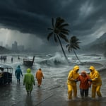
Thailand has flipped the thermostat and turned on the storm dial: a bracing cold snap in the north is rubbing shoulders with ferocious storm systems in the south, and the Thai Meteorological Department (TMD) has issued a nationwide wake-up call. A powerful high-pressure mass is sweeping the upper south, ushering in chilly mornings, strong northeasterly winds and dry, gusty conditions across much of the country. At the same time, a vigorous northeast monsoon over the Gulf of Thailand and the upper Andaman Sea — teamed with a low-pressure zone over the lower south — is whipping up widespread heavy rain, thunder, and dangerously high seas.
What’s driving the wild weather?
Think of Thailand’s atmosphere as a theater where two big performers are sharing the stage. The first is the cold, dense high-pressure system pushing down from the north, which is dropping morning temperatures and ramping up wind speeds across northern, northeastern, central and eastern provinces. The second act is the northeast monsoon, amplified by a southern low-pressure trough, stirring the waters of the Gulf and Andaman Sea into a churning performance of storms and rough surf.
Regional snapshot — what to expect
Here’s a friendly, no-nonsense breakdown of the forecast (6am today to 6am tomorrow):
- Northern Thailand: Wake up to crisp air. Early-morning lows will sit between 15–19°C in the plains, dancing up to 25–31°C by day. Mountainous districts will be genuinely frosty for Thai standards, with dawn temperatures plunging to 3–11°C. Northeasterly winds will push 10–20 km/h — enough to make scarves feel essential.
- Northeastern Thailand (Isaan): Expect cool to cold mornings with blustery conditions. Temperatures will dip to 13–18°C before climbing to 26–28°C in the afternoons. At higher elevations, summit thermometers could read as low as 6°C, with stiffer winds of 15–35 km/h making it feel even colder.
- Central Thailand: Mornings will be refreshingly cool — around 20–21°C — warming to 28–29°C by afternoon. Persistent breezes of 10–30 km/h will keep the air moving and the dust swirling.
- Eastern seaboard: Cooler mornings (19–22°C) and comfortable afternoons (27–30°C). Strong northeasterly winds of 20–40 km/h will shove waves up to about 2 metres near shore, with greater heights further out.
- Bangkok and vicinity: A brisk start to the day at 21–22°C, easing into a warm afternoon of 28–31°C. Northeasterly winds at 10–30 km/h will make mornings feel especially fresh.
- Southern Thailand — Gulf side (east coast): This is the danger zone. Provinces including Nakhon Si Thammarat, Phatthalung, Songkhla, Pattani, Yala and Narathiwat will bear the brunt, with heavy to very heavy rain, persistent winds of 20–40 km/h and temperatures stuck around 21–24°C in the mornings, nudging to just 27–28°C by day. Wave heights in the Gulf are forecast at 2–3 metres and can climb above 3 metres during thunderstorms. Small boats should remain ashore — please, don’t tempt fate.
- Southern Thailand — Andaman coast (west coast): From Krabi up through Ranong expect widespread rain with some heavy downpours. Temps will range roughly 23–28°C, while northeasterly winds of 20–40 km/h will drive seas to about 2 metres near shore and over 3 metres in storms. Further south in Trang and Satun, winds may ease a little (20–35 km/h) but waves can still exceed 2 metres when thunderstorms roll through.
Practical tips — stay safe and sensible
This isn’t just weather channel fodder — it has real implications for safety, agriculture and travel. A few commonsense pointers:
- Layer up: northern and northeastern residents — especially those in highland districts — should bring out warmer clothing and keep vulnerable family members cozy.
- Protect crops and livestock: farmers should check greenhouses, secure coverings and be ready to move sensitive stock out of exposure zones.
- Watch the fire risk: dry, windy conditions can fan fires. Avoid open burning and secure flammable materials.
- Maritime caution: small boats should stay ashore. Larger vessels must exercise extra caution — monitor official advisories and head for safe harbor if conditions deteriorate.
- Travel smart: expect localized flooding and slick roads in the south; plan extra travel time and avoid low-lying coastal routes during peak storms.
Final word
Thailand’s weather has flipped between two very different moods: crisp, wind-chilled mornings up north and walloping monsoon storms in the south. Heed TMD alerts, be mindful on the water, protect crops and property where you can, and enjoy the dramatic weather show from a safe distance. Whether you’re sipping hot tea under a mountain sky or watching thunderheads cross the Gulf, this is weather you’ll remember — responsibly.


This forecast sounds serious — fishermen need to listen. I know a few boat owners who’ll ignore the warnings and that’s a disaster waiting to happen.
As someone with family who fishes, I get the economic pressure, but small boats should stay ashore until seas calm. A single storm wipeout ruins lives for years.
Exactly, Nina. It’s not just money, it’s lives. Authorities should consider temporary compensation or harbor anchoring to discourage risk.
You both sound well-meaning, but harbors are expensive and most small crews don’t trust compensation promises. They go out because bills are due, not because they’re brave.
Then the problem is systemic — safety nets and enforcement. Letting people risk everything because they ‘can’t wait’ is brutal and avoidable.
My neighbor says this is all exaggerated and that the TMD wants attention. Is the media hyping up normal seasonal changes?
Skepticism is healthy, but downplaying warnings when boats are capsizing is irresponsible. The maps and wind speeds are measurable, not clickbait.
I get that, Larry, but sometimes alarms cause panic and unnecessary business shutdowns. There should be balance between caution and common sense.
This is like when my school cancels recess for a drizzle—overreaction. People adapt every year, right?
Historical climatology suggests these combined systems can produce localized severe events. It’s not mere noise; data show spikes in incidents during such patterns.
As a meteorologist I’ve tracked northeast monsoon amplifications becoming more common. The interaction with a southern low can produce surprisingly fast intensification of seas and convection.
Thanks for that context, Dr. Kim. Our rescue team is prepping, but community communication is patchy in remote provinces.
Chaiwat, coordinate with provincial TMD liaisons and local radio — those are often the best channels in remote zones. Early alerts save time.
Science is clear, but on the ground it’s farmers like me who struggle. Cold snaps damage seedlings and storms wash away terraces; data doesn’t buy fertilizer.
I hear you. Forecasts aim to give lead time so communities can take action, but that requires resources and trust in the system.
This cold front is the worst timing for my greenhouse tomatoes. I already lost a batch last year after a surprise chill.
Put up extra tarps and keep animals sheltered, friend. When it got cold here last year we slept with blankets over the seedlings and saved most of them.
Consider thermal mass like water barrels in greenhouses to buffer temperature swings; low-tech solutions can mitigate frost effects.
Thanks Mae and Prof. Zhang. I’ll try water drums and tarps tonight — community tricks matter more than fancy tech for many of us.
Cool mornings sound awesome, but the storm part is scary. I hope parades and weekend plans get canceled before someone gets hurt.
Canceling events is political; businesses will gripe. But public safety should trump profit when seas and winds are that high.
Totally. Better bored than buried. Schools should at least warn parents if coastal trips are planned.
The weather is dramatic poetry — thunder and tea. But please, don’t go surfing in 3-meter swells for Instagram clout.
Bangkok’s breeze sounds lovely, but the south getting hammered worries me for supply chains and food prices. Ports could be disrupted.
Are flights affected too? I’m supposed to travel to Surat tonight and I’m nervous about delays.
Kitti, regional flights might delay if winds and visibility drop. Check airlines and allow extra time; coastal roads can flood fast.
If you have to go, bring warm layers and avoid coastal shortcuts. I’ve seen cars get stranded by flash floods in the south.
This confluence of a strong continental high and a southern low is a textbook case study of transient extremes. We should be collecting detailed observations for research and policy.
Agreed. Field measurements, especially sea state data and convective indices, would help validate models and improve short-term warnings.
If universities partner with local agencies we can create rapid-deployment sensors. Academic involvement can be practical, not just theoretical.
Does that mean more taxes or research money diverted from other needs? People want immediate help, not studies.
We’re setting up extra shelters near the coast and urging fishermen to stay put. Volunteer teams are on standby for rapid response.
Bless you, rescue teams. My sister lives near Songkhla and she was worried; hearing active prep calms people down.
Mae, tell your sister to follow local radio and to secure belongings high. We’ll try to get water and blankets to farmers if roads hold.