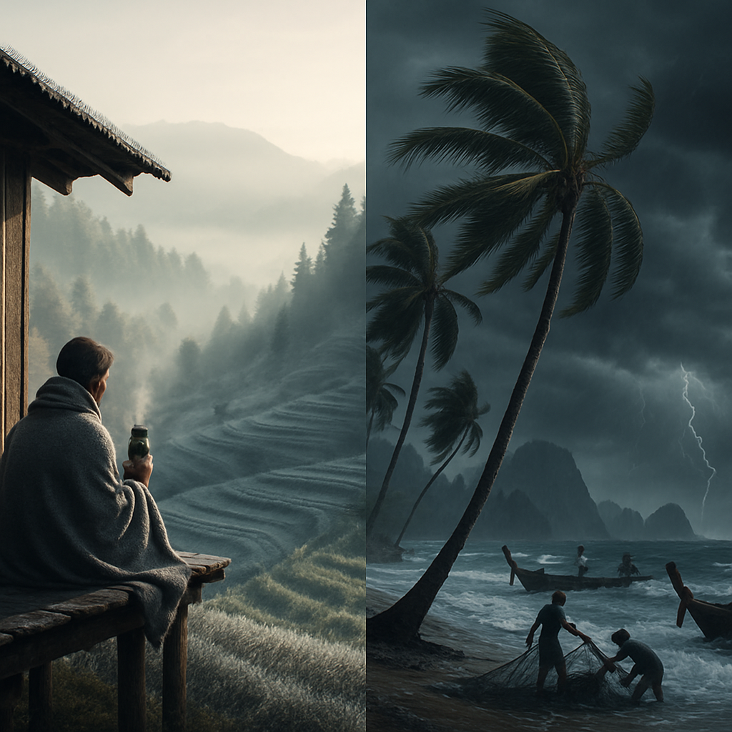
Grab an extra blanket and a thermos of something warm — Thailand is feeling the chill. The Thailand Meteorological Department (TMD) has issued its 24-hour outlook for November 29–30, 2025: a reinforcing high-pressure system is sweeping cold air across the upper North and parts of the South, ushering in decidedly colder temperatures, brisk winds and some weather drama along the coasts.
What’s happening and why it matters
A dome of high pressure over the region is shoving cooler air southward, which means the North and Northeast will feel the sharpest drop — with some mountain tops flirting with frost. Meanwhile, the northeast monsoon continues to rattle the Gulf of Thailand, the Andaman Sea and the South’s coastal strips, bringing blustery conditions and localized heavy showers.
Mariners take note: waves are forecast to rise to around two metres in places and exceed that where thunderstorms brew. Inland, authorities remind residents to keep an eye out for fire hazards — dry, windy weather can turn a careless spark into a fast-moving blaze.
Regional snapshot — November 29–30
Here’s the forecast in plain language, with the numbers you want if you’re packing a bag, planning fishing, or scheduling a market run:
- North: Colder still. Lows of 8–13°C, daytime highs 25–29°C. Mountain tops will be very cold and frost is possible — temperatures up high could dip as low as 2°C. Winds from the northeast at 10–20 km/h.
- Northeast: Cold to very cold with stronger gusts. Lows 7–13°C, highs 25–28°C. Mountain peaks could see 4–10°C. Expect northeast winds at 15–35 km/h.
- Central: Cool to cold mornings and breezy conditions. Lows 11–16°C, highs 26–29°C, with northeast winds 10–30 km/h.
- East: Cool to cold with robust winds. Lows 13–19°C, highs 27–30°C. Northeast winds 20–35 km/h; seas 1–2 metres and increasing to around two metres offshore.
- South — East Coast (Gulf side): Upper South turning cool to cold with a slight drop in temperature. Lower South mainly scattered thunderstorms (about a 20% chance) but isolated heavy downpours likely in Pattani, Yala and Narathiwat. Lows 15–25°C, highs 26–30°C. Northeast winds 20–35 km/h. Waves around 2 metres, higher where storms form.
- South — West Coast (Andaman side): Scattered thunderstorms (chance about 20%), chiefly in Trang and Satun. Lows 21–23°C, highs 29–32°C. Northeast winds 20–35 km/h. Waves 1–2 metres, larger in thunderstorm-prone and offshore areas.
- Bangkok and vicinity: Cool and windy with a slight further dip in temperatures. Lows 16–18°C, highs 28–30°C, northeast winds 10–30 km/h.
Tropical systems — Koto and company
Two systems are being watched beyond Thai waters. Tropical Storm Koto is currently over the central South China Sea and is forecast to approach the Vietnamese coast between November 30 and December 2. But the strong high-pressure area sitting over Vietnam and the upper South China Sea should sap Koto’s strength quickly, so major impacts are expected to be limited.
There’s also a tropical depression east of Malaysia moving toward the central South China Sea. Good news for Thailand: meteorologists do not expect either Koto or the depression to directly affect the kingdom.
Practical tips and travel notes
- Layer up. Morning and night in the North and Northeast can feel particularly sharp — think sweaters, scarves and warm beverages.
- If you live or travel in highland areas, be frost-aware. Protect sensitive plants and prepare vehicles for cooler starts.
- Boat operators and coastal communities should monitor sea-condition bulletins; wave heights will be higher near thunderstorms.
- Keep a fire-safety plan at hand. Dry, windy conditions increase the risk of wildfires; dispose of embers safely and heed local advisories.
In short: it’s a crisp, brisk spell across much of Thailand with pockets of wet weather and choppy seas along the coasts. Stay warm, stay safe, and if you’re heading south to Pattani, Yala or Narathiwat — bring an umbrella for the chance of heavy showers. The TMD will keep updating forecasts, so tune in for the latest if you have outdoor plans or sea-faring adventures.







Thanks for the heads-up. We just harvested some vegetables in Chiang Mai and I’m worried about frost damage.
Wrap the seedlings in burlap and put plastic covers over the pots at night — worked for my family last year.
Good idea, Nong — I’ll do that tonight and move some plants under the shelter.
This is why small farmers need better local alerts; a push notification would save crops and money.
Two-metre waves? That’s enough to keep my crew in port. Not worth risking small boats for a few fish.
Exactly — insurance won’t cover reckless decisions. Wait it out and check the bulletins every few hours.
People underestimate how quickly thunderstorms can pile up in the Andaman; 2 metres can get ugly fast.
I’ve seen a 2-metre swell turn into a nightmare when the wind shifts offshore. We’re staying dry this run.
Why don’t the government pay fishermen when seas are rough? We do dangerous work but never get help.
The reinforcing high-pressure dome is a textbook northeast monsoon pattern; short-term cold snaps like this have clear synoptic drivers.
Can you explain why mountain tops get frost but Bangkok stays mild? I’m in 11th grade and curious.
Sure, but trending data show cold extremes in some places are linked to anthropogenic climate change disrupting jet streams.
Partial credit: anthropogenic forcing affects background state, but the immediate cause here is the pressure gradient and radiative cooling overnight.
Is frost like snow? I’ve never seen it — will it hurt my bike?
Frost is thin ice on surfaces, Joe. It won’t wreck a bike but watch for slippery roads at dawn.
Thanks, I’ll be careful on the ride to school and wear a hoodie.
This kind of sudden cold is why we lose citrus flowers some years; TMD should send targeted alerts to orchards.
We lost half our crop last winter to a similar event. Electric fans and propane heaters helped some neighbors save trees.
Propane heaters raise costs and emissions; better to invest in frost-tolerant rootstocks and microclimate management where feasible.
Agreed on rootstocks, but smallholders need practical, low-cost measures now — not theories for next decade.
Cold and breezy morning plus potholes — my commute just got twice as risky. City needs better road repairs.
Tell me about it — I slipped on a wet manhole cover last year. Riders should slow down, but authorities must fix infrastructure.
Public transport gets crowded in cold spells because everyone wants to avoid the wind; that creates other safety concerns.
I’ll try the train tomorrow, but walking from the station in gusts is a problem too — umbrellas aren’t great on windy days.
They always blame weather systems but never admit urban planning and deforestation make it worse. Coincidence? I don’t think so.
Land-use change does influence local climate, but attributing a synoptic cold wave solely to deforestation ignores atmospheric dynamics.
Maybe, but when rivers run faster and soils dry, the whole system is altered. People should stop cutting trees and expect miracles.
Good tips about layers and frost — I’d add checking water pipes at night if you’re in the highlands.
Also protect livestock with extra bedding; animals feel the cold too and production drops quickly when nights are freezing.
Exactly — last year I lost two chickens because we didn’t think to move them into the shed on a cold snap.
Schools in the North should delay outdoor sports mornings; kids will be shivering and not focused.
Agreed. My child came home with a cough after being exposed to cold winds during morning drills.
Cold spells disprove global warming, right? Seems like weather is just normal to me.
Short answer: no. Weather is local and variable; climate is long-term averages. You can have cold days within a warming trend.
Maybe, but people use every cold snap to push policies that hurt the poor. Be careful with big promises.
Fisheries and tourism take a hit when seas are rough. Need better compensation schemes for small operators.
Compensation is tricky but seasonal relief funds and microinsurance could help; requires political will and financing.
Are tropical storms Koto and the depression a real threat to Thai coasts or just clickbait?
Okay reading it properly now — looks like limited direct impact, but indirect sea changes could affect fishermen.
Why aren’t we investing more in early-warning systems? This bulletin is fine but tech could push alerts faster to remote communities.
Local radio plus SMS and community volunteers would save lives and crops; simple, low-tech solutions still work best in rural areas.
Markets will see less produce if frost hits — prices might go up and low-income families suffer most.
Short supply shocks do raise prices temporarily; targeted food subsidies could cushion the poorest households.
I live on the coast and love the cooler air, but the rough seas are a no-go for my kayak trips. Safety first.
Kayakers often overestimate calm — check updated sea bulletins and avoid headlands where gusts spike.
Frost sensors and cheap IoT thermometers could alert farmers before damage — start-ups should offer rental models.
Technology is great, but if power goes out what then? Need simple backups and hands-on community plans.
Tourists in the North love cold weather, but many come unprepared. Hostels should advertise blankets and hot drinks.
I nearly froze last year because I flew in with flip-flops. Shocking how many travelers don’t check weather alerts.
Cold snaps increase respiratory cases — clinics should stock up on basic meds and warm bedding for patients.
We’re already reallocating resources to anticipate higher patient loads over the next few nights.
This is a reminder that urban green spaces can moderate microclimates; we should protect them rather than concrete over them.
Greenspaces are nice but where’s the money? Developers don’t prioritize long-term climate resilience without incentives.
Then let’s push for policy incentives and green infrastructure grants so developers act now.
Advisory to all small-boat operators: avoid offshore travel where waves exceed 1.5 metres and monitor updates hourly.
Appreciate the clear guidance — we’ll pass it along at the pier and keep radios on all night.
Please everyone remember children in remote schools may not have warm clothes; community donations help a lot.
We’re organizing a drop-off at the temple tomorrow morning — bring scarves and blankets if you can.
If frost probability is high, market gardeners could stagger harvest times to reduce total loss; plan B is essential.
Staggering helps but labor and storage are issues. We need better supply-chain supports to make that strategy work.
I sailed these waters for 40 years — respect the sea and you’ll live. Forecasts help but experience matters.
Respecting and listening to the elders is how we learn. We’ll be cautious and review safety gear tonight.
Please reporters: avoid sensational phrases like ‘weather drama’ without context — it scares people unnecessarily.
Fair point. We try to balance urgency with accuracy, but clicks push the language sometimes. Will be more careful.
If Koto doesn’t hit Thailand, why did they bother mentioning it? Feels like fear inflation to me.
They mention it because nearby systems can influence local sea states and spillover moisture; it’s part of comprehensive situational awareness.
Reminder: elderly folks lose body heat faster. Check on neighbors and make sure homes are safe and heated if possible.
I’ll call Mrs. Anan tomorrow — she lives alone and her stove is old. Good reminder everyone.